
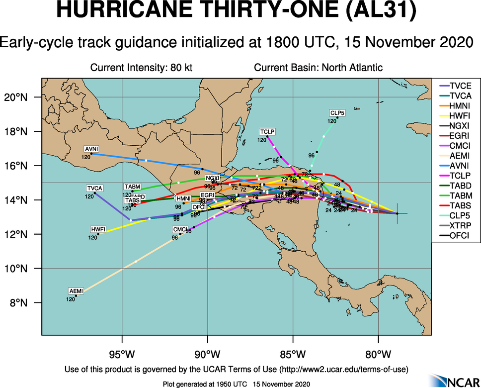
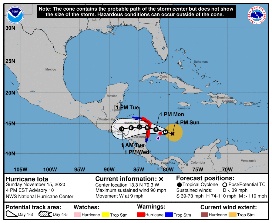
Here’s this afternoon’s Hurricane Iota update, both the spaghetti model & NOAA’s predictions (4pm EST). On the NOAA graph, M denotes a Major Hurricane, whereas we’ve often just seen H for Hurricane. This is worse! The cold front north of us seems to be pushing the storm southward, with predictions of devastating the mainland of Honduras a second time, right on the tail of Hurricane Eta. This means that Utila should just experience tropical storm effects only on Tuesday, as opposed to previously predicted hurricane force winds tonight around midnight.
Many people are asking where to make donations for the mainland. Please do so here: https://wrghonduras.org/hurricane-eta (where 100% of the funds go to relief). I know the organizers personally and they do so much to aid those in Honduras, and the people of Honduras need it now more than ever, as most are still digging their way out after Hurricane Eta. American tax payers can receive a deduction from this donation. Please help.